The Des Plaines River Trail is one of the most significant trails in Chicagoland because of how it connects communities from the Wisconsin border all the way to the near-west suburbs of Brookfield and Forest Park.
In Cook County, the Des Plaines River Trail has the potential to connect key destinations such as the Illinois Prairie Path, the Salt Creek Trail, the Medical District, the CTA Blue Line, and the Brookfield Zoo.
There are a number of exciting trail improvements underway, some of which will make the path usable for more of the year by rerouting it away from flood-prone areas. Other improvements will make it safer to reach the trail from key points in nearby communities, such as the CTA Blue Line Station in Forest Park.
NORTHERN SEGMENT
Several improvements are being considered for the northern segment, which runs 10 miles from Touhy Avenue to North Avenue. One upgrade would lengthen the trail an additional two miles so that it connects to the Illinois Prairie Path.
Other improvements include:
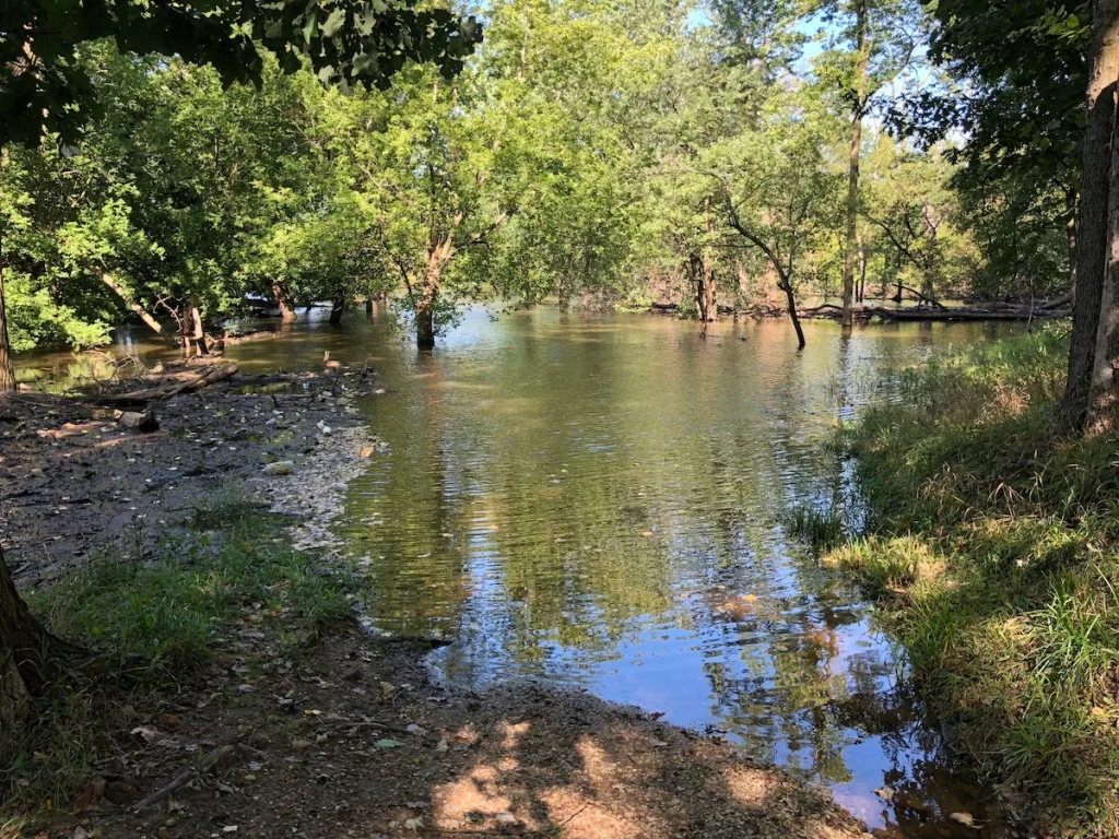
- Trail reconstruction and/or reroutes in places where the trail regularly floods (see top photo)
- New and improved crossings of arterial streets
- Potentially rebuilding portions of the trail on a boardwalk because of flooding
- New connections to nearby trails
CENTRAL SEGMENT
The central part of the trail is currently undergoing a feasibility study led by Active Transportation Alliance and Civiltech Engineering that is focused on closing the 2.5-mile trail gap between the Forest Park Blue Line station at Van Buren Street and 26th Street near the Salt Creek Trail.
Trail users wishing to connect to and from communities to the south must currently travel along wide, busy streets or wind through disconnected residential streets. This is why it is necessary to create a clear, identifiable, low-stress, on-street option to fill in the gap.
Work began in February 2022 to identify the route and is expected to be wrapped up at the end of this summer.
A major part of the study was surveying community members to gather direct input. Over 300 community members took the survey and many of them expressed a great deal of excitement about the project because of improved access to trail destinations.
People also expressed a desire for improved crossings at major roads, underpasses, and overpasses; improved access to key destinations such as Brookfield Zoo and the CTA Blue Line; and for more sidewalks, personal safety, signage, and lighting.
To connect the trail with the Forest Park Blue Line station, four routes are currently being considered that offer a combination of low-stress on-street routes and side paths, but one of them stands out over the others.
The Medical Campus Alignment, as it’s known, runs from the Illinois Prairie Path to 9th Avenue to Roosevelt Road through the Medical Campus (at Frontage Road and 2nd Avenue) to Cermak Road, 5th Avenue and then 26th Street.
This route is the highest rated because of how it’s a direct route, connects the trail to local destinations, considers wetland impacts and land acquisition, and offers 24-hour access.
Other routes under consideration are less viable because of limited access to key destinations, higher expenses, and more construction complications.

SOUTHERN SEGMENT
Running between 26th Street and Ogden Avenue, the southern section of the Des Plaines River Trail in Cook County has a couple of gaps appearing between the Prairie Path, the Salt Creek Path, the CTA Blue Line, and the Proposed Thatcher Wood Path.
Filling these gaps would allow for more connections to local suburban communities, mass transit, and recreational bike routes. The creation of a safe sidewalk and a new intersection at Maybrook and 1st Avenue would help close one of these gaps.
While big, multi-faceted projects like this are exciting, they also bring their challenges. One of the challenges is making sure that the new trail sections — as well any new connector trails — are properly maintained once they are built.
Another challenge in a project like this is the coordination that is needed among the large number of municipalities and organizations involved. The Des Plaines River Trail encounters many jurisdictions and each have to be included in the planning and construction.
We’re expecting that the overall benefits of these trail improvements will be huge — and more people will be able to enjoy this treasure that exists in our west and northwest suburbs.
____________________________
Active Transportation Alliance recently hosted a webinar focused on upcoming improvements to the Des Plaines River Trail. If you want to learn more about the projects underway, check out the recording of the webinar.
Olivia Borowiak, the author of this post, is an intern for the Active Transportation Alliance.