Because the Chicago River has emerged as one of the city’s premier destinations, it’s important we improve walking and biking along the river so that all Chicagoans can safely enjoy it.
That’s exactly what’s happening in our project to identify and push for walking and biking upgrades along the Riverwalk and Upper Wacker Dr. on the Main Branch of the Chicago River.
The study area starts at the intersection of the Riverwalk and the Lakefront Trail, and runs the entire length of the Riverwalk west to Lake Street and includes existing bike routes between Randolph to the south and Illinois St. to the north.
This is where we’d love your input. Are you familiar with this area? Do you live, work, commute through, or shop in the area? What connections would make it easier for you to get around on foot and bike and access transit?
Please take our survey and share widely with your friends, family, and colleagues.
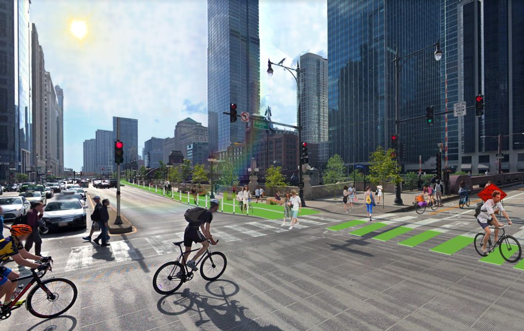
Taking the survey will show your support for potential walking and biking upgrades on Upper Wacker (pictured) and inform recommendations that’ll eventually be presented to the city. Your input will also shape our advocacy priorities.
It’s an important moment for the City of Chicago to take the lead on improving walking and biking given the high density of the Loop as well as its many tourist attractions and numerous commercial districts.
That’s why we’re studying the feasibility of adding space for people walking and better coordination of pedestrian signals throughout the area. We’re also exploring the possibility of building a protected bike route on Upper Wacker.
The city would see an immediate return on its investments since we know these upgrades would improve public health, strengthen economic development, and create a cleaner environment.
It’s inevitable the demand for better walking and biking in the area will explode as the city extends the Riverwalk south from Lake Street to Ping Tom Park. And to the north, we’d like to see a connection between the Wild Mile Chicago and Lincoln Yards — both will add riverfront paths from Chicago Avenue all the way to Cortland Avenue.
Getting safe and comfortable routes for walking and biking along the Main Branch is also an important part of the effort for a continuous Chicago River Trail. When the 312 RiverRun is completed in the summer of 2020, Chicago will only need to add 10 more miles of trail to connect the entire river via trail.
With seventy percent of the world expected to live in cities by 2040, we must seize this opportunity to connect a transformational path that will link people to jobs, recreational opportunities, green space, and shopping districts.
Survey participants will be added to the Chicago River Trail campaign and receive project updates.
Image courtesy of Ross Barney Architects